
Pointing the way!
Today was a toughie I must say, but so much fun!
Most days we aim to sample approximately 50 sites in order
to meet the three week deadline of completing 568 sample sites. But today was
only 23. Why? I hear you ask, well here is why.
Today was a 5am start. Up ready and out before the sun, An
approximately 30 minute drive to where the 4 x 4 will be left for the day; just
east of El Paso, up in the hills by the loggers tracks, about 800m above sea
level.
The Ruta del Los Los Volcanes runs across the crest of
Cumbre Vieja ridge and is truly magical, walking above the so called 'sea of
clouds', there is a wide range of geological and volcanic features. It's a
one-of-a-kind landscape with the dizzying depths of Hoyo Negro, the lapilli
fields of Montañas de Feugo, lava tubes and the warm grounds of Teneguía. This
ridge is the site of over half the volcanic activity in the Canary Islands
during the last 500 years.
It is 7.30am. Here begins the hike and days sampling. We
start by checking we have all the necessary equipment and off we go. We
gradually climb to the top of the most northerly and highest point of Cumbre
Vieja; Pico de Birigoyo which sits at an elevation of 1945m above sea level.

Samara, Paulo and Hannah starting part of the ascent - 1200masl, 750m to go!
During the ascent it was possible to see across to Tenerife
and Mount Teide rising above the clouds surrounding the island brought in on
the trade winds. Further up and from the summit, it was also possible to see La
Gomera and El Hiero.
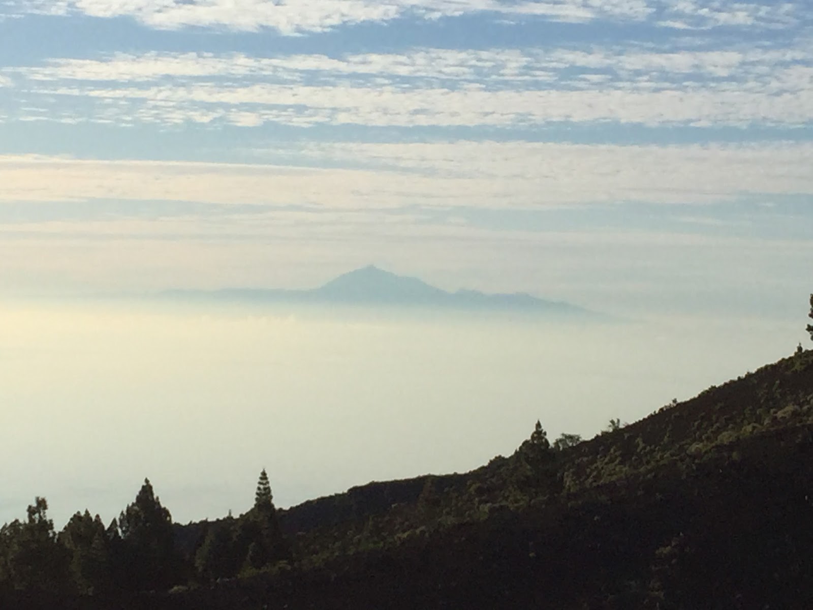
A hazy Teide as seen from half way up Birogoyo
At the summit we stopped to take our first samples of the
day, 2 soil gas samples, surface temperatures, ambient temperatures and CO2
efflux data. The view from the top was pretty cool and very beautiful
with the buildings in the town of El Paso just tiny little specs so far down.
From here we could see the ocean on both sides of the island with ease.

At the summit of Pico de Birogoyo
Once ready, ensuring we had not left behind any equipment we
set off walking south down in to a small valley that separates Birigoyo and the
volcanic cone of Barquita.
We sample in the small valley and as we make our way around
Barquita, then again as we descend slightly. The paths are far from even,
straight or even of easy walking, but rather zigzags left and right, up and
down and volcanic, well everything from weathered and crumbly lava to welded
tuffs or unconsolidated deposits.
The day is beginning to get warm, with the added physical
activity and the elevation to contend with leading to lower oxygen levels in
the body, dehydration and ease of sun burn if you're not careful - so we all take our time. By about 10
am it was a quick stop to sample and a little refuel, then off again.
The first impressive sight of the day is Hoyo Negro eruption
centre, one of the vents (in this case large vent) that forms Volcán Nambroque.
The other two vents of this volcano are Duraznero and Llano del Banco, the
volcano is better known as San Juan.

Hoyo Negro
It is known as San Juan because on 24th June 1949, Saint
John's Day, the volcano came to life. The eruption began in the southern vent
of Duraznero where a lava lake formed and over flowed down the eastern side of
the Cumbre Vieja ridge.


Part of the Duraznero lava lake
A voluminous lava flow began at Llano del Banco on July 8th.
The large volumes of lava flowed down the western flank all the way to the sea
forming an extensive coastal platform.
On July 12th the very deep vent of Hoyo Negro erupted, the
violent eruptions thought to be the most explosive on the Canary Islands of historical
times, were degassification eruptions of the system, no lava was emitted.
During this three phase eruption an earthquake occurred with
its epicentre near Jedy. The result of this was fault propagation to the
surface and a 2.5km long trace with maximum vertical displacement of 4m between
Hoyo Negro and Duraznero. It has not been identified to the south of Duraznero
and traverses down slope to the north of Hoyo Negro. These fault surface traces
(the San Juan fault) are the first of their kind on the island and are the
reason for the concerns regarding slope instability of the western flank of
Cumbre Vieja. In 2000, the BBC broadcast a program in which suggestions were
made that half of Cumbre Vieja could collapse in to the Atlantic Ocean. Several
articles have been released in the last 15 years or so that have concentrated
on modelling various aspects of the western flank of Cumbre Vieja. These models
look at volcanic scenarios, collapse scenarios, fault networks, lengths of
faults and tsunami modelling and all suggest any major collapse and resultant
tsunami is highly unlikely.
Lava flows from this eruption flowed down both the east and
the western flanks with the main flow on the west appearing at the surface to
the north and flowing down to the sea.
This eruption was the first on the Canary Islands in the
20th century, there had been 13 years of earthquakes on and around La Palma in
the run up to the eruption.


A small section of the fault trace. The offset towards the bottom of the image is about 50cm.
Continuing on with our sampling and volcano hiking, after
climbing a steep path where the underfoot conditions were poor because of ash
(sometimes felt like walking on the spot!) next we arrive at Montaña Negra. Walking
along a narrow path, we stop to sample and we are above the clouds - I'm on top
of the world!!!!!!


Above the clouds!
We are starting to descend from the ridge crest now, with
just a few sample sites to go. We are walking through pine forests and ash
fields that have been pockmarked by huge and beautifully shaped volcanic bombs


Teardrop shaped volcanic bomb - one of thousands!
Time to head home, we descend through the lapilli fields of
Montaña de Fuego to the west of San Martin, making it to our meeting point
where a member of the council of Fuencaliente comes to collect us. He drops us
back to the accommodation, then takes Samara and Paulo back to collect the car
while Hannah and I sort through the samples and data from the day's big
adventure in the sky.
After a very long day, a 21km hike with field equipment in
tow an early night was had by all and a much needed day off tomorrow is
required by all.
Every day is an adventure!
Buenas noches de La Palma
No comments:
Post a Comment